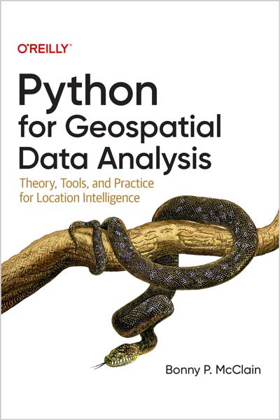
Theory, Tools, and Practice for Location Intelligence
Bonny P. McClain
#Python
#Geospatial
#Data_Analysis
#PyQGIS
#Cloud
#Google_Earth
#Algorithms
🎨 نکته مهم قبل از سفارش چاپ: این کتاب پر از تصاویر و نمودارهای رنگی هست که در نسخه سیاهوسفید جزئیاتشون از بین میره. اگه میخوای واقعاً ازش استفاده کنی، اگر از PDF کمک نمیگیری حتماً نسخه رنگی رو بگیر.
🗺 توی علم دادههای مکانی، قانون کلی اینه که چیزهایی که در فاصلهی نزدیکتر به هم قرار گرفتن، معمولاً شباهتهای بیشتری دارن نسبت به مواردی که دورتر هستن.
📚 این کتاب عملی، به همهی حرفهایهای حوزه مکانی، دانشمندهای داده، تحلیلگرهای کسبوکار، جغرافیدانها، زمینشناسها و هر کسی که با تحلیل و بصریسازی داده آشناست، مبانی تحلیل دادههای مکانی رو یاد میده تا بتونن سوالهای خودشون رو عمقیتر بررسی کنن.
👩💻 نویسنده Bonny P. McClain نشون میده که چرا کشف و کمّیسازی الگوها داخل دادههای مکانی اینقدر حیاتی هست. کتاب با ترکیب پلتفرمهای متنباز و تجاری، بهت یاد میده چطور دادههای مکانی رو پردازش و بصریسازی کنی.
🚀 هدفهای اصلی یادگیری در کتاب:
🌐 درک اهمیت روابط مکانی داخل تحلیل داده
🗺 کار با دادههای Raster و Vector و لایهبندی اونها
📍 استفاده از دادههای مکانی برای انجام Spatial Analytics
🎨 طراحی نقشههای دقیق و قابل فهم برای تحلیلها
⚙️ خودکارسازی دادههای جغرافیایی با اسکریپتهای پایتون
📦 کشف و استفاده از پکیجهای پایتونی برای امکانات بیشتر
🔻 کار با دادههای خاص مثل Polygon، فایلهای Shape و سیستمهای Projection
🖌 فهم قواعد و Syntax گرافیکی در علم دادههای مکانی برای کنجکاوی و خلاقیت
📄 فهرست فصلها
فصل 1: مقدمهای بر تحلیلهای مکانی
فصل 2: امکانات ضروری برای Spatial Analysis
فصل 3: QGIS – استفاده از PyQGIS و الگوریتمهای Native
فصل 4: تحلیل مکانی در فضای ابری – Google Earth Engine و ابزارهای مشابه
فصل 5: OpenStreetMap – دسترسی به دادههای مکانی با OSMnx
فصل 6: ArcGIS Python API
فصل 7: GeoPandas و آمار مکانی
فصل 8: پاکسازی دادهها
فصل 9: کتابخانه GDAL (Geospatial Data Abstraction Library)
فصل 10: استفاده از پایتون برای سنجش دادههای اقلیمی
👥 نویسنده درباره کتاب
📍 بانی میگه این کتاب رو برای دو گروه نوشته: کسایی که تازه وارد دنیای GIS شدن و پایتون بلدن، و کسایی که تازه پایتون یاد گرفتن ولی در GIS حرفهای هستن. هدفش این بوده که یادگیری ابزارها رو جالب و درگیرکننده کنه، نه خشک و سنگین.
🖥 توی هر بخش، ابزار یا تکنیک رو معرفی میکنه و ازت میخواد همزمان نصبش کنی و با Jupyter Notebook یا Google Colab کد رو اجرا کنی. بعدش هم تجربههای بیشتر و تمرینهای اضافه برای ادامهی کار میذاره.
🔧 تمرکز کتاب روی ابزارهای متنباز هست تا مانعی بابت هزینه نباشه، ولی استفاده از راهحلهای سازمانی رو هم رد نمیکنه.
🗃 این کتاب خطی پیش نمیره؛ مسیر یادگیریش مثل “انتخاب مسیر خودت” طراحی شده و برای انواع داده، ابزار و محیط کار، سناریوهای مختلف ارائه میده.
👤 درباره نویسنده
🌍 Bonny P. McClain تحلیلگر دادههای مکانی، انسانجغرافیدان و انسانشناس اجتماعی هست. علاقهمند به بررسی تعاملات پیچیده بین محیطزیست، اکوسیستمها و فعالیتهای انسانی، و اینکه چطور این عوامل شکل زمین و تعادل محیطی رو تغییر میدن.
📊 علاوه بر کار فنی، از تحلیلهای داده برای بحثهای اجتماعی مثل فقر، نژاد و جنسیت استفاده میکنه تا اثر ساختارها و عدالت اجتماعی رو بهتر نشون بده.
In spatial data science, things in closer proximity to one another likely have more in common than things that are farther apart. With this practical book, geospatial professionals, data scientists, business analysts, geographers, geologists, and others familiar with data analysis and visualization will learn the fundamentals of spatial data analysis to gain a deeper understanding of their data questions.
Author Bonny P. McClain demonstrates why detecting and quantifying patterns in geospatial data is vital. Both proprietary and open source platforms allow you to process and visualize spatial information. This book is for people familiar with data analysis or visualization who are eager to explore geospatial integration with Python.
This book helps you:
- Understand the importance of applying spatial relationships in data science
- Select and apply data layering of both raster and vector graphics
- Apply location data to leverage spatial analytics
- Design informative and accurate maps
- Automate geographic data with Python scripts
- Explore Python packages for additional functionality
- Work with atypical data types such as polygons, shape files, and projections
- Understand the graphical syntax of spatial data science to stimulate curiosity
Table of Contents
Chapter 1. Introduction to Geospatial Analytics
Chapter 2. Essential Facilities for Spatial Analysis
Chapter 3. QGIS: Exploring PyQGIS and Native Algorithms for Spatial Analytics
Chapter 4. Geospatial Analytics in the Cloud: Google Earth Engine and Other Tools
Chapter 5. OpenStreetMap: Accessing Geospatial Data with OSMnx
Chapter 6. The ArcGIS Python API
Chapter 7. GeoPandas and Spatial Statistics
Chapter 8. Data Cleaning
Chapter 9. Exploring the Geospatial Data Abstraction Library (GOAL)
Chapter 10. Using Python to Measure Climate Data
Who Is This Book For?
My vision for Python for Geospatial Data Analysis presented me with a conundrum: how do you write a book for newly minted geospatial professionals who know Python and for newly minted Python programmers who are well versed in geospatial analytics? I decided simply to make it interesting. My goal isn’t to grant you professional expertise at either end of the spectrum but to bring us all together to learn tools and best practices.
By the end of this book, I want all of you to feel proficient and confident enough to go out and explore geospatial analytics on your own. To that end, as I teach each tool and technique, I ask you to follow along, installing the tools as needed and using a Jupyter or Google Colab notebook to run code. But I don’t want you to stop there, so I also provide a host of different experiences that invite you to continue to explore.
How This Book Works
We will begin with a quick level set introducing you to a few key GIS concepts. As we advance, I’ll slowly integrate Python learning. I do not assume expertise in a coding language or in geospatial analytics.
The resources presented here are open source: their source code is distributed freely by the developers and usually incorporates contributions from community members. Most make use of Python. To the best of my ability, I’ve ensured that this book features resources available without burdensome subscription services. Any costs, however modest, are highlighted so that you can make informed decisions. My focus on open source doesn’t mean that I don’t support enterprise solutions; it means I want to lower the barriers to conducting meaningful analysis around big questions.
This book covers a wide swath of open source tools and data and looks at a variety of datasets, some of which you perhaps don’t have access to in your current professional role. Python for Geospatial Data Analysis is not linear like typical books about technology (or, for that matter, about Python). There are multiple ways to explore data problems. Perhaps you can draw inspiration from working in an integrated development environment (IDE) for the first time. Maybe you’re curious about working in a terminal or console.
It is impossible to walk through the granular details of each Python package or library in a single book. If you’re familiar with a particular tool or library, you probably have favorite features that I haven’t included here. That’s fine—I just want to give you a feel for each one. From there, you can continue discovering what they have to offer.
Review
"I love how comprehensive this is!" g.iablonovski
"This is amazing! I'm so glad you wrote this thank you so much! " Ryan Schaner
"Beautiful book!" Pablo Moreno
"In the expanding market of Geospatial analytics I am sure this is a very useful resource. I read through the already available content and I found it very illustrative." Ezequiel Garcia Hernandez
Excellent book. Great production quality to go along with the fantastic content on #LocationIntelligence.--Kirk Borne, Chief Science Officer
From the Author
In both python and geospatial resources I found a gap initially difficult for me to cross. The beginner resources were too fundamental but when I dropped into the specific modules, datasets, or open-source tools covering the topics of interest -- I felt like I missed something. Even navigating the user documentation it seemed there were important concepts that were time consuming to have to learn independently before moving onto the project or deeper analyses.
I decided to write Python for Geospatial analysis in an attempt to fill the void. Ten information packed chapters covering the foundational tools for your learning journey. These topics were picked by me to reflect a workflow that can help you on your journey. It isn't one size fits all but it is definitely a choose your own adventure that reflects the skills available for you to integrate the power of open-source tools.
From the Inside Flap
Tobler's first law of geography states, "Everything is related to everything else, but near things are more related than distant things." But if you look at Tobler's second law, "Phenomena external to a geographic area of interest affect what goes on inside it," you can see why a geographer and data analyst brings the science of location into data stories and large-scale research projects.
With this practical book, geospatial professionals, data scientists, geographers, geologists, and others familiar with data analysis and visualization will learn the fundamentals of spatial data analysis.
Author Bonny P. McClain demonstrates why detecting and quantifying patterns in geospatial data is vital. This book is for curious, eager professionals or citizen scientists hoping to explore geospatial integration with Python.
You will learn how to:
- Apply spatial relationships to data questions
- Work with both raster and vector graphics
- Design informative maps using open source tools and publicly available datasets
- Automate geographic data with Python scripts
- Understand the graphical syntax of spatial data science to
- stimulate curiosity
About the Author
Bonny is a geospatial analyst and self described human geographer and social anthropologist. Exploring geographic properties that capture complex interactions, dynamic shifts in ecosystem balance and how activities influence eco-geomorphic conceptual frameworks across a wide variety of environments are the topics of popular public talks and panel discussions.
The ability to apply advanced data analytics, including data engineering and geo-enrichment, to poverty, race, and gender discussions targets judgments about structural determinants, racial equity, and elements of intersectionality to illuminate the confluence of metrics contributing to poverty.
Bonny is the author of the books Python for Geospatial Data Analysis: Theory, Tools, and Practice for Location Intelligence (publisher, O'Reilly Media) and Geospatial Analysis with SQL: A hands on guide to performing geospatial analysis by unlocking the syntax of spatial SQL published by Packt Press. Current projects include a new book in progress with Locate Press, Geospatial Data Science & the Art of Storytelling.
